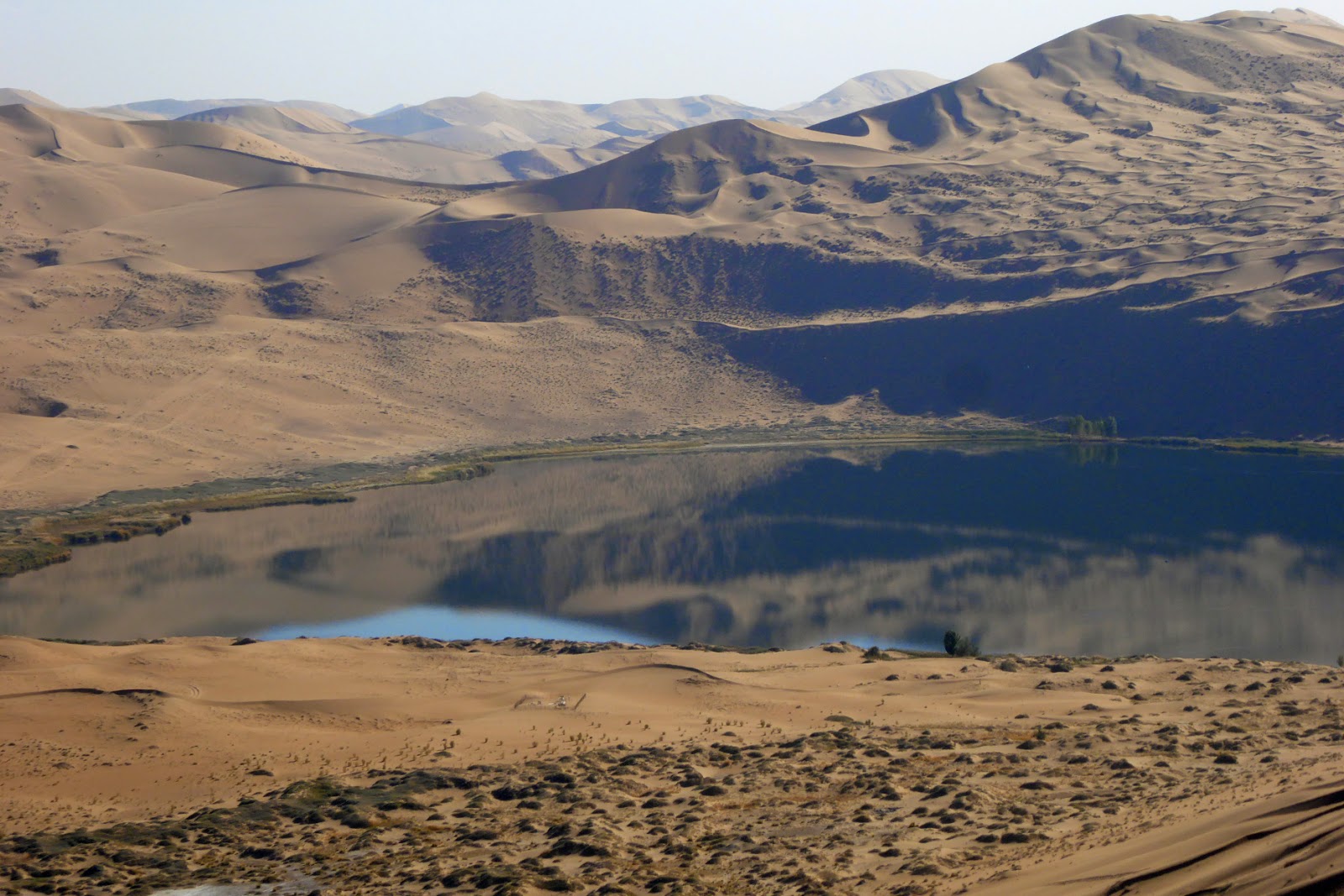
The Badain Jaran Desert is a desert in China which spans the provinces of Gansu, Ningxia and Inner Mongolia. It covers an area of 49,000 sq. kilometers. By size it is the third largest desert in China.
This desert is home to some of the tallest stationary dunes on Earth. Some reaching a height of more than 500 meters although most average at around 200 meters. Its tallest dune is also measured, from base to peak, as the world's third tallest dune and highest stationary dune in the world.
The desert also features over 100 spring-fed lakes that lie between the dunes, some of which are fresh water while others are extremely saline. These lakes give the desert its name which is Mongolian for "mysterious lakes". It is also crossed by one river, the Ruo Shui ("weak water"), which has formed an alluvial plain in the desert.
Lakes
The Badain Jaran Desert is well known for its numerous scattered and colorful lakes. Containing more than 140 lakes they are mainly found in the southern region in the desert. These lakes can easily be found in the larger valleys between large dunes. They are believed to provide the life sustenance in the desert supporting camels, goats and horses which are herded by nomads that travel through the desert. Most lakes also support a green ring of vegetation that populate the close vicinity around the lakes.
Some lakes throughout the desert change color due to large populations of algae, Brine shrimp and mineral formations at different times in year. Evaporation can also allow others to turn into a hypersaline lake forming a salt crust around the rim of the lake.
Although their true sources are still debated it is believed that they are being maintained by underground water streams. Most arid deserts in China are surrounded by mountains that provide water sources, and this is the case with the Badain Jaran Desert. Runoff from the mountains is then collected through gravel deposits and this allows them to run through the desert, providing water sources for the scattered oases.
Within the desert there can be two main types of lakes found regarding their morphometry. The largely elongated shallow lakes mainly appear in the megadune area in the southeastern margin of the desert. Their depth often reaches less than 2 meters and only measure about 2 square kilometers. The oval-shaped, deep lakes can also be found in the compound transverse megadune area. Their maximum depth reaches around 15 meters and attain a maximum size of around 1.5 square kilometers. The lake water can be extremely saline. The shallow lakes in the southeastern region of the desert tend to have low salt concentration, averaging at less than 20 g/L. Other lakes can show higher salt concentrations going up to more than 330 g/L.
巴丹吉林沙漠,位于中国内蒙古自治区阿拉善盟阿拉善右旗北部,雅布赖山以西、北大山以北、弱水以东、拐子湖以南。面积4.43万平方公里,是中国第三大沙漠,其中西北部还有1万多平方公里的沙漠至今没有人类的足迹。主要属内蒙古额济纳旗和阿拉善右旗,东部小范围属阿拉善左旗。巴丹吉林系蒙古语,沙漠以一居民点而得名。沙漠海拔高度在1200-1700米之间,沙山相对高度可达500多米,必鲁图峰海拔1617米,垂直高度约435米,堪称”沙漠珠穆朗玛峰”。处于阿拉善沙漠中心,气候干旱,流动沙丘占沙漠面积的83% ,移动速度较小 。中部有密集的高大沙山,一般高200 ~ 300 米,最高的达 500米。以复合型沙山为主,为北 30°~40°东方向排列,系西北风的强大影响所致。
高大沙山的周围为沙丘链,一般高20~50米。沙丘和沙山上长有稀疏植物,西部以沙拐枣、籽蒿、麻黄为主;东部主要为籽蒿和沙竹,沙拐枣、麻黄等逐渐减少。边缘生长芦苇、芨芨草等 ,为主要牧场。有些湖盆边缘有淡水泉出露,为治理沙漠提供了条件。巴丹吉林沙漠平均每10平方公里不到1人。在整个沙漠内部,仅有巴丹吉林庙和库乃头庙两大居民点。基本无种植业。全部经营牧业,骆驼为该地主要家畜,数量居中国各旗县之冠;次为山绵羊。沙漠内部无固定道路,横穿腹部异常困难,中部及东北部基本为无水区。东南部的雅布赖盐湖盛产食盐,西部的古鲁乃湖及巴丹吉林庙附近的一些湖泊内有碳酸钠的沉积。
奇峰、鸣沙、湖泊、神泉、寺庙堪称巴丹吉林“五绝”。受风力作用,沙丘呈现沧海巨浪、巍巍古塔之奇观。巴丹吉林沙漠占阿拉善右旗总面积的39%,相对高度200~500米,是中国乃至世界最高沙丘所在地。宝日陶勒盖的鸣沙山,高达200多米,峰峦陡峭,沙脊如刃,高低错落,沙子下滑的轰鸣声响彻数公里,有“世界鸣沙王国”之美称。沙漠中的湖泊星罗棋布,有113个之多,其中,常年有水的湖泊达74个,淡水湖12个,总水面4.9万亩,湖泊芦苇丛生,水鸟嬉戏,鱼翔浅底,享有“漠北江南”之美誉。沙漠东部和西南边沿,生动记录狩猎和畜牧生活的曼德拉山岩画,被称为“美术世界的活化石”。


No comments:
Post a Comment